
Home / Serviços
Laser Scanner

The Laser Scanner technology is know internationally for LiDAR (Light Detection and Ranging). This technology is capable of generating digital models numerical dense and accurate, both the topography (DTM - digital terrain model) as the vertical structure of the surface may exist on it (DSM – Digital Surface Model or DEM - DigitalElevation Model).
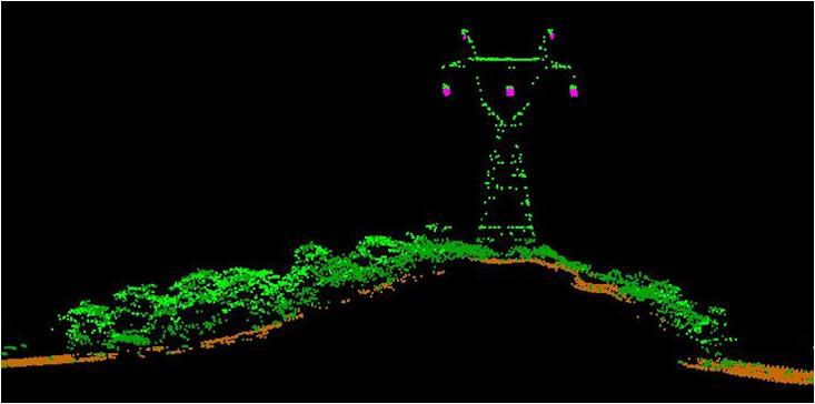
FIDUCIAL already made maps of more than 8,8 mi² with this technology, achieving improved results primarily in forested areas, where you can perform the removal virtual vegetation and other structures built artificially can be seenbecoming thus a tool that is attractive to end users of topographic data and applications in several areas.
Products Generated
The products generated from the post-processed data can be delivered in ASCII (text), shapefile and grid of ArcGIS or CAD(AutoCAD or MicroStation). Usually the product generated is fragmented as an articulation of leaves defined by the customer, since the volume of information is too large. For output to a text file, there is the possibility to export not only the coordinate of the point, but the intensity of the laser sensor feedback too. All data are defined in a System of Map Projection (UTM) and referenced to the Brazilian Geodetic System (SIRGAS) or whatever the customer wants.
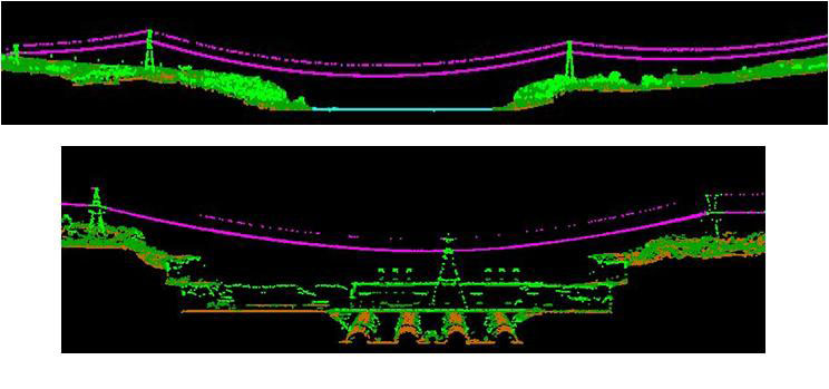
Longitudinal Point Cloud. Font: Lactec
Cross Point Cloud. Font: Lactec
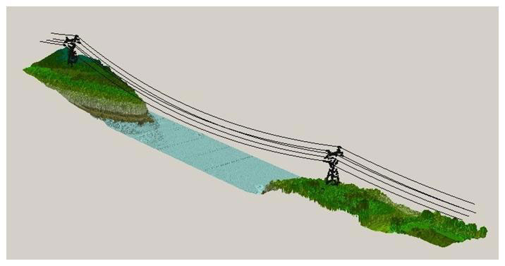
Three-Dimensional Point Cloud. Font: Lactec
